Drone Mapping & Surveys for Construction
Stockpile measurements, cut and fill calculations, orthomosaics, terrain models and construction progress monitoring for housebuilders, earthworks contractors and civil engineers.
Georeferenced data, checked before delivery and supplied in the formats your engineers and quantity surveyors already use.
Based in Northumberland, working across North East England and the UK.
Prefer to talk it through? Call 07970 393381.

- AuthorisedCAA Operational Authorisation (PDRA01)
- QualifiedGVC and A2 CofC remote pilot qualifications
- Site accessCSCS card holder
- Insured£5 million public liability insurance
- ControlledRTK, GNSS ground control and independent checkpoints
Construction & Earthworks Surveys
All servicesSix surveys for housebuilders, earthworks contractors and civil engineers. Each one answers a practical question about your site.


Example Survey Outputs
Measured outputs rather than just aerial photographs. Each example links to the full service.

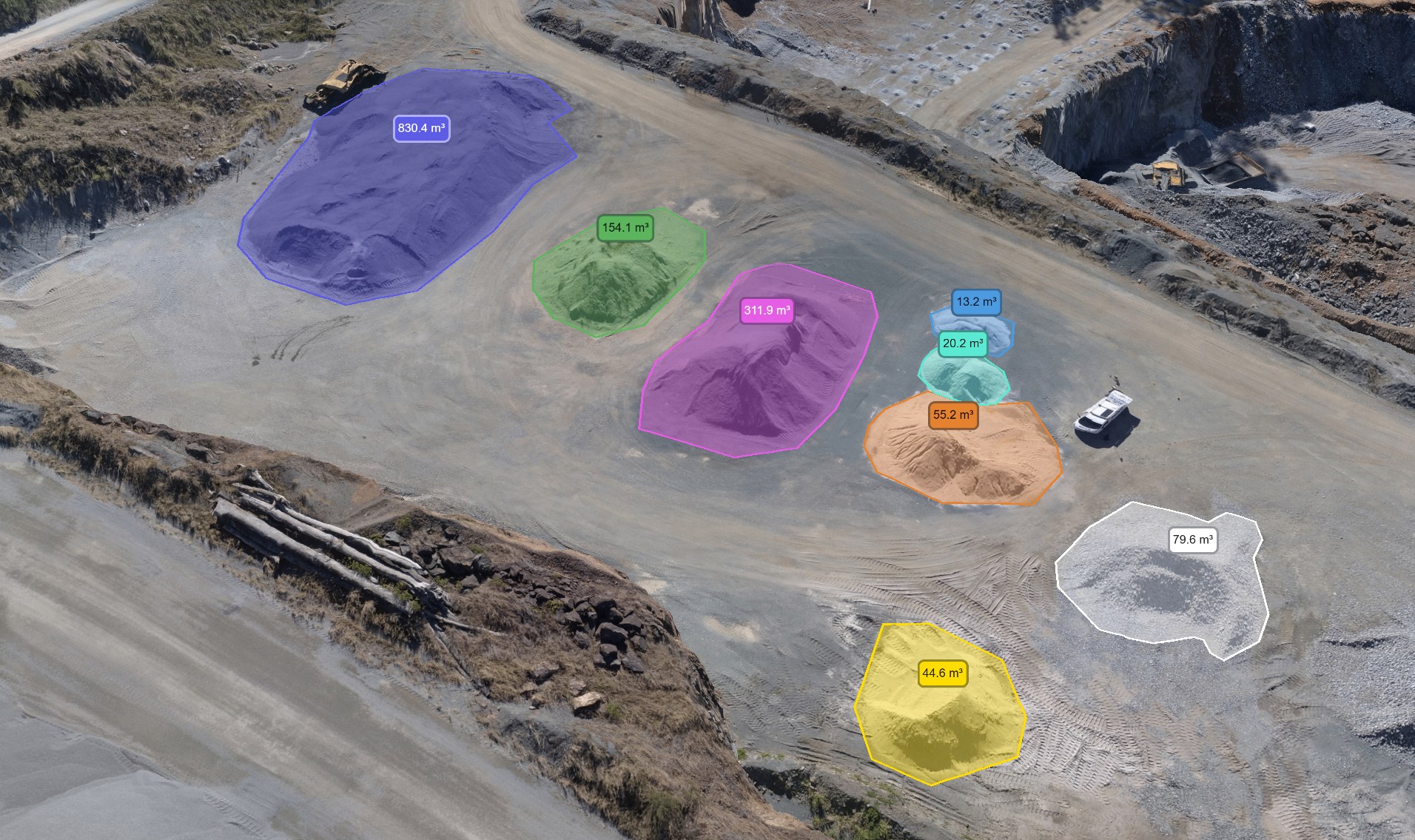
Stockpile Volume Measurements
Each pile is outlined on a 3D surface model and its volume calculated in cubic metres (m³) against an agreed base surface. Measured figures support stock reconciliation, ordering and material planning.
Stockpile volume surveys
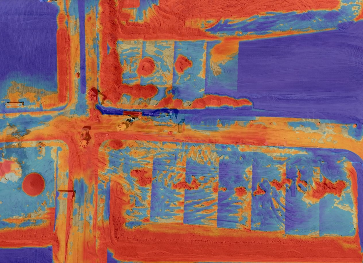
Cut & Fill Against Design
The surveyed ground is compared with your design surface. Colours show where the ground sits above or below design, and the report gives cut, fill and net quantities in cubic metres.
Cut and fill surveys

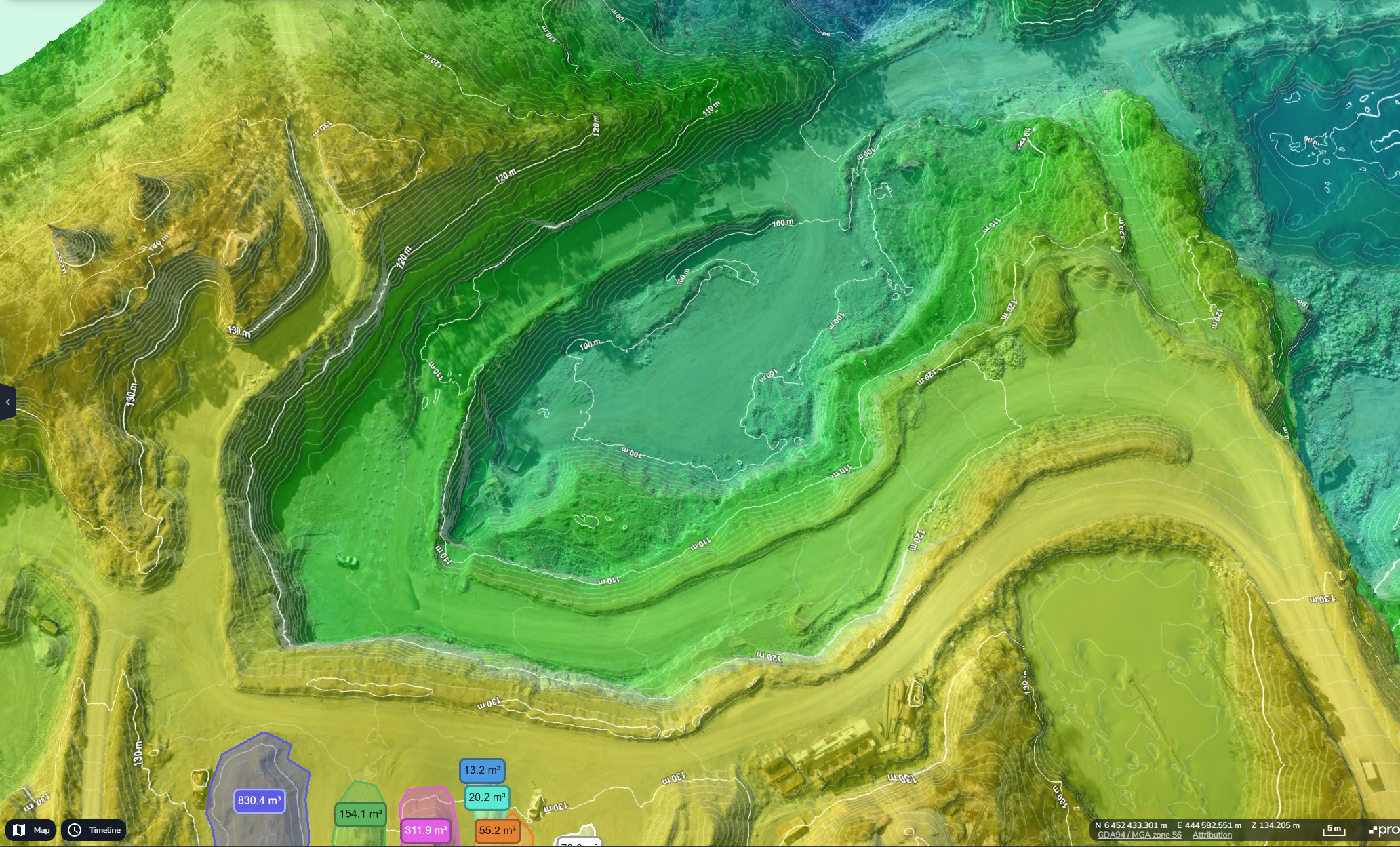
Site Mapping & Elevation Models
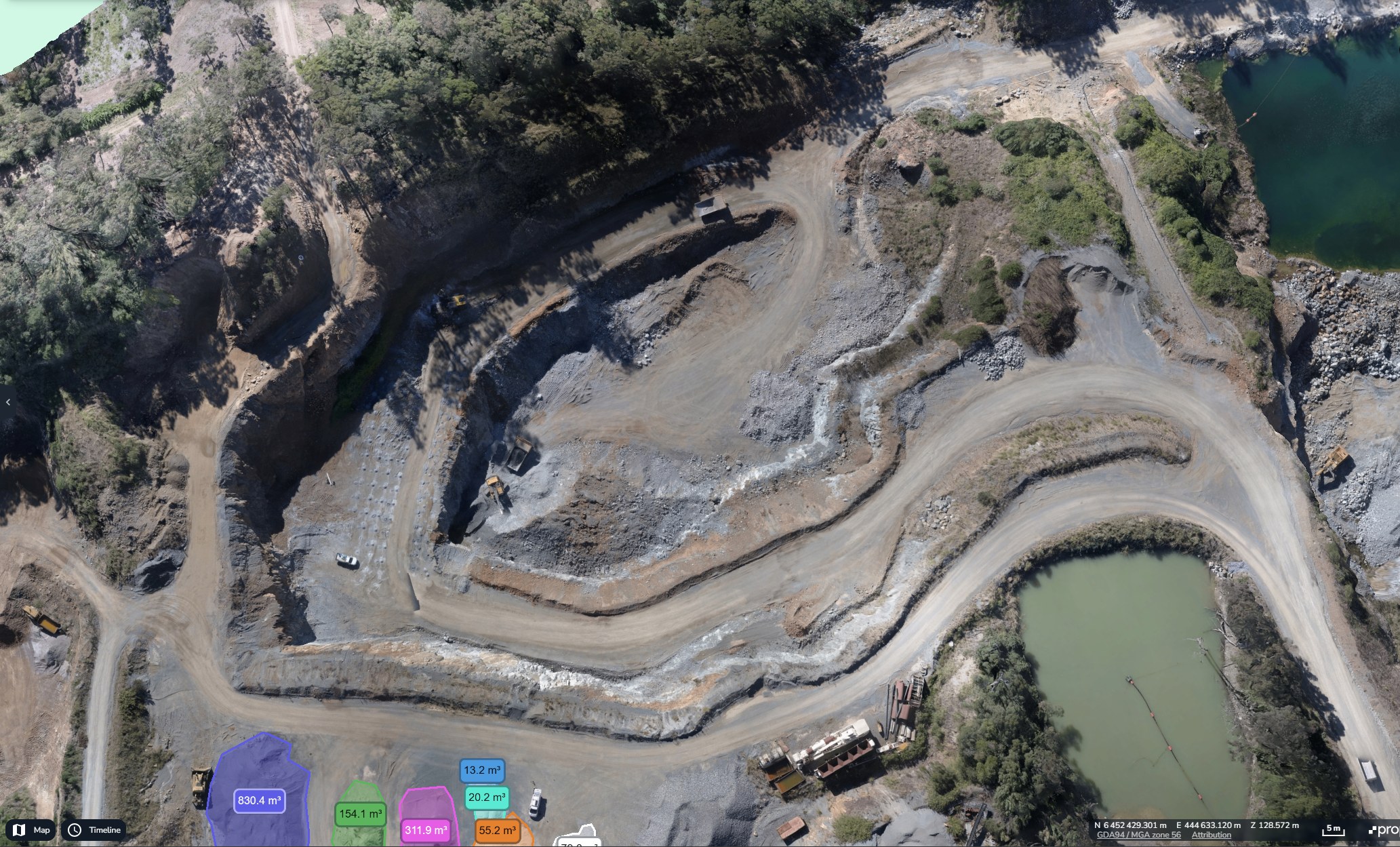
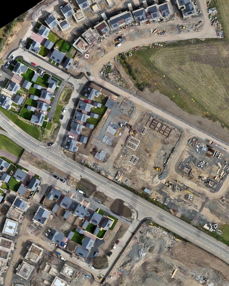
A dated orthomosaic and an elevation model with contours, from the same capture, show what is on site and how the ground rises and falls, so engineers can review levels, slopes and likely drainage from the office.
Topographical mappingWhat You'll Receive
Measurable, georeferenced data in standard formats for CAD, GIS and project reporting.
- Georeferenced orthomosaicsGeoTIFF, ECWMeasurable aerial maps of the whole site, typically 1 to 5 cm per pixel.
- Elevation and terrain modelsGeoTIFF, LandXMLSurface and ground models for levels, slopes and design.
- Point clouds and 3D modelsLAS, LAZ, OBJDense 3D data and textured models of sites and structures.
- Volume reportsPDF, CSVStockpile, cut, fill and net volumes in cubic metres.
- Design comparisonsPDF, GeoTIFFSurveyed ground and site layout compared with design levels and drawings.
- CAD and GIS exportsDWG, DXFContours and spot levels for your software, with fully drafted drawings by arrangement.
- Dated progress recordsGeoTIFF, JPEGComparable maps and fixed viewpoints from every visit.
- Interactive online modelsBrowser linkDetailed 3D models to explore and share in a web browser.
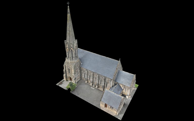
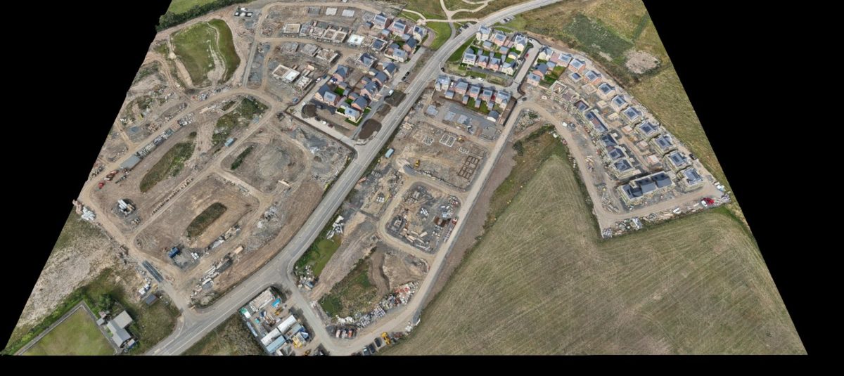
Housing Development, North East
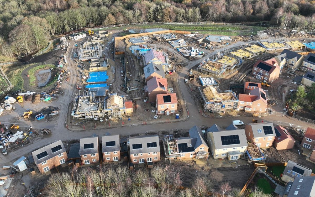
View the projectA residential development in the North East, captured across multiple visits to document construction progress and provide accurate, up-to-date site records.


- What was captured
- Repeat flights over the whole development on the same flight plan, oblique photographs from fixed viewpoints, and overlapping imagery for a 3D model.
- What was produced
- Georeferenced orthomosaics from each visit, matched before-and-after views and a textured 3D model of the development.
- Why it is useful
- Repeat captures on the same flight plan allow plots, roads and earthworks to be compared between dates, and the whole site can be examined from any angle without a site visit.
- How it could help your project
- The same approach gives housebuilders and contractors a dated record for progress meetings, valuations and client updates, and a baseline for measured earthworks, as-built records or design comparisons.
Repeat Surveys Throughout Construction
The most useful records come from returning at agreed intervals or milestones. Surveys use consistent capture and control methods to support reliable comparisons between visits.
- BaselineBefore work starts: existing ground, site condition and a reference map.
- EarthworksStrip, cut, fill and stockpiles recorded as the ground is shaped.
- SubstructureFoundations, drainage and roads recorded across the site.
- SuperstructureRegular maps and fixed viewpoints as buildings go up.
- CompletionA final dated record of the finished site for handover.
Benefits of regular visits
- Consistent, site-wide records on every visit
- Ground and site changes compared between dates
- Earthworks quantities and material movement tracked where measured surveys are included
- Material for monthly reports and progress meetings
- Stakeholders kept informed without extra site visits
- Progress reviewed at agreed project milestones
Preferential rates for repeat visits
Regular surveys at agreed intervals or project milestones are priced at a preferential rate per visit, because planning and set-up are shared and the same capture and control methods are used each time.
One Point of Contact, Start to Finish
Your enquiry goes straight to the person who plans the survey, flies the site and processes the data. From our base in Northumberland we work across Newcastle, Tyne and Wear, County Durham and the wider North East, and travel across the UK for commercial projects.
Flexible scheduling
Surveys are planned around your programme and site activity, from a single visit to regular monitoring.
Measured, not just photographed
Outputs are georeferenced and checked, so your team can measure from them, not only look at them.
Consistent repeat surveys
The same flight plan, control and processing methods on every visit, to support reliable comparisons between dates.
Clear about limits
Photogrammetry measures what the camera can see. Where ground is hidden by dense vegetation or structures, we say so plainly.
Measured surveys use RTK positioning, GNSS ground control and independent checkpoints. Accuracy depends on site conditions, method and control, so it is checked on each project rather than promised in advance. How survey data is controlled.
How It Works
- DiscussTell us about the site and what you need to know. You do not need to know which survey you need.
- PlanWe agree the outputs and coordinate system, check the airspace and prepare RAMS for the visit.
- CaptureThe site is flown to a planned pattern, with survey control where measurement matters.
- Process and checkImagery is processed into maps, models and measurements, then checked before anything is delivered.
- DeliverMaps, models, reports and data files in your formats. Inspection imagery can often be supplied the same day and mapping outputs within a few working days, with timescales agreed for each project.
See Our Work
All projects