Drone Construction Progress Monitoring
Keep a clear, dated record of your construction project from start to finish.
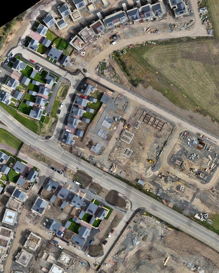
Droneacres returns to your site at agreed intervals to capture dated, georeferenced maps and fixed-viewpoint photographs, so project managers, quantity surveyors and site engineers can review progress, compare visits and keep stakeholders informed from one consistent record.
Indicative priceFrom £550 + VAT per visitWhat affects the price
Prefer to talk it through? Call 07970 393381.

More than aerial photographs
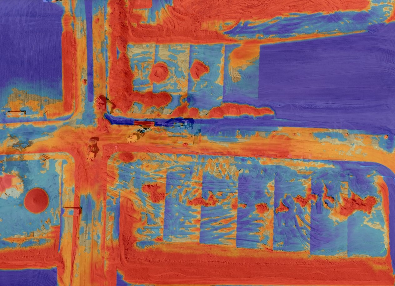
Each visit follows the same flight plan and survey control, so maps and photographs from different dates can be compared reliably. That turns a set of aerial images into a measurable record: you can compare plots, roads and earthworks between dates, check what has changed and see the whole site at once.
For housebuilders, main contractors and civil engineering teams, a regular record supports project meetings, client updates and valuations, and gives a dated reference if questions come up later.
Typical applications
- Weekly, fortnightly or monthly progress records
- Site-wide orthomosaics on every visit
- Comparing site conditions between dates
- Recording earthworks and construction stages
- Material for project and client meetings
- A visual record of completed work
- Spotting site changes and potential discrepancies
Regular visits through the whole build
The most useful records come from returning at agreed intervals or milestones. Surveys use consistent capture and control methods to support reliable comparisons between visits.
- BaselineBefore work starts: existing ground, site condition and a reference map.
- EarthworksStrip, cut, fill and stockpiles recorded as the ground is shaped.
- SubstructureFoundations, drainage and roads recorded across the site.
- SuperstructureRegular maps and fixed viewpoints as buildings go up.
- CompletionA final dated record of the finished site for handover.
What regular visits give your team
- Consistent, site-wide records on every visit
- Ground and site changes compared between dates
- Earthworks quantities and material movement tracked where measured surveys are included
- Material for monthly reports and progress meetings
- Stakeholders kept informed without extra site visits
- Progress reviewed at agreed project milestones
Preferential rates for repeat visits
Regular surveys at agreed intervals or project milestones are priced at a preferential rate per visit, because planning and set-up are shared and the same capture and control methods are used each time.
Progress mapping starts from £550 + VAT per visit for a straightforward site.
See the difference between visits
Drag the handle, or focus it and use the arrow keys, to compare two Droneacres visits to the same housing development.


What you receive
- Dated aerial site mapsGeoTIFF, PDFA high-resolution orthomosaic of the whole site on each visit
- Repeatable viewpoint photographsJPEGOblique photographs from the same positions every time
- Before-and-after comparisonsPDF, JPEGThis visit against any earlier visit
- Comparison viewsPDF, JPEGSide-by-side or overlaid comparisons for reports and meetings
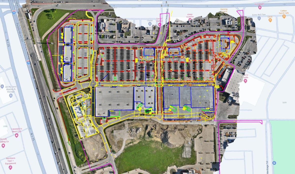
- Annotated progress imagesPDFImages marked up with plots, areas or points to check
- Optional extrasAgreed per project3D models and measured ground or material changes
Who uses it, and the decisions it supports
- Project and construction managers
- Progress meetings, programme reviews and client updates from one dated map.
- Quantity surveyors
- A visual record of work in place at each valuation date.
- Site engineers
- Check what has been built and where, and compare it with the previous visit.
- Housebuilders and developers
- Keep head office, clients and other stakeholders informed without extra site visits.
What it gives your team
One shared view
Everyone works from the same dated map, whether or not they are on site.
Fewer wasted visits
Office teams can check progress and take measurements from the map.
A lasting record
Dated captures help settle questions about what was built and when.
How the work is done
- Set upAgree the interval, key viewpoints, outputs and who receives each update.
- First visitThe flight plan and ground control are set up and the baseline is captured.
- RepeatThe same plan is flown on each visit, weather permitting.
- ProcessMaps and photographs are processed and compared with the previous visit.
- ShareOutputs are delivered in formats the whole team can open, with online viewing where it is agreed for the project.
Consistency and limitations
Comparisons are most reliable when every visit uses the same coordinate system, flight plan and ground control, with good quality data and consistent processing. Where measured outputs are included, checkpoints are measured again and the results reported.
Aerial photographs record what is visible from above at the time of the flight. Work inside buildings, behind scaffold sheeting or beneath other structures cannot be seen.
What affects the result
- Weather and light on the day of each visit
- Ground control marks disturbed between visits
- Cranes and new structures changing the flight plan
- Parked plant and materials hiding parts of the site
Indicative price
This is an introductory starting price for a straightforward project, not a fixed price for every site. Your quotation depends on the size and complexity of the site, travel, access, processing, ground control, reporting and the deliverables you need. VAT is additional.
Frequently asked questions
How often should a construction site be mapped?
It depends on the pace of work and how the information is used. Monthly visits suit valuations and client reporting, while weekly or fortnightly visits suit fast-moving phases such as groundworks. Some projects only need visits at key milestones.
Can you measure progress as well as photograph it?
Yes. Because each map is georeferenced and controlled, areas, lengths and volumes can be measured and compared between visits, and measured ground or material changes can be added to any visit.
Cut and fill surveysCan reports be shared with different contractors?
Yes. Maps, images and reports are supplied in common formats that you can pass to anyone you choose, and 3D models can be shared through an online viewer that opens in a web browser.
Do the flights interrupt construction work?
Flights are agreed with the site manager and planned around cranes, deliveries and site activity, so work can usually carry on as normal.
How soon after each visit are the outputs ready?
Delivery times depend on the site, the survey requirements and the outputs you need. Inspection imagery can often be supplied the same day, and maps and 3D models can often be prepared within about two working days. More complex mapping and surveying deliverables may take around three working days or longer. Timescales are agreed for each project.
How much does drone progress monitoring cost?
Construction progress mapping starts from £550 + VAT per visit. Your quotation depends on the size and complexity of the site, travel, access, processing, ground control, reporting and the deliverables you need. Regular surveys at agreed intervals or project milestones are priced at a preferential rate per visit, because planning and set-up are shared and the same capture and control methods are used each time.
Related services
All services