Drone 3D Modelling & Photogrammetry
Explore buildings, construction sites and landscapes in detailed 3D.
Droneacres captures overlapping high-resolution imagery to create realistic, measurable three-dimensional models. These can help with planning, inspection, condition documentation and understanding complex structures without repeated site visits.
Indicative priceFrom £650 + VATWhat affects the price
Prefer to talk it through? Call 07970 393381.

Types of 3D output
A 3D capture can produce several different outputs from the same photographs. Which you need depends on whether you want to look at the subject, measure it or use it in design software.
Practical applications
- Construction site visualisation
- Building documentation
- Condition assessment
- Preliminary measurements
- Heritage conservation
- Planning construction access
- Recording assets before and after work
3D terms, explained
- Textured 3D models
- A realistic mesh with photographic texture, for viewing, inspecting and presenting.
- Dense point clouds
- Millions of measured points, for use in CAD, BIM and modelling software.
- Digital surface models
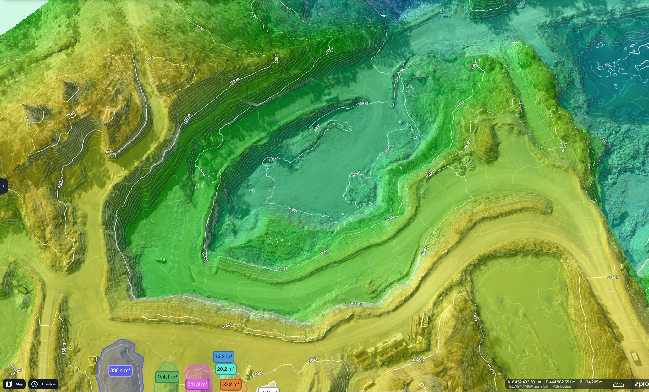
- The height of everything visible across a site, as a grid.
- Terrain models
- The ground surface, with buildings and vegetation removed where the data allows.
- Online 3D viewing
- Detailed models that clients and project teams can explore in a web browser.
3D Modelling Projects
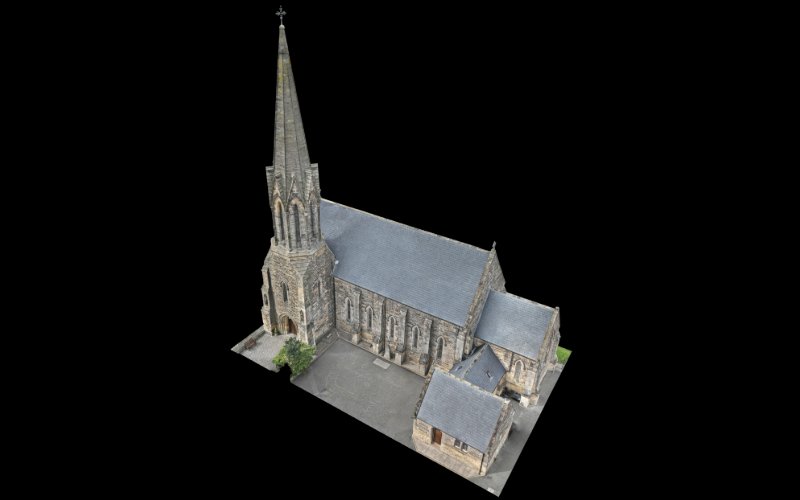
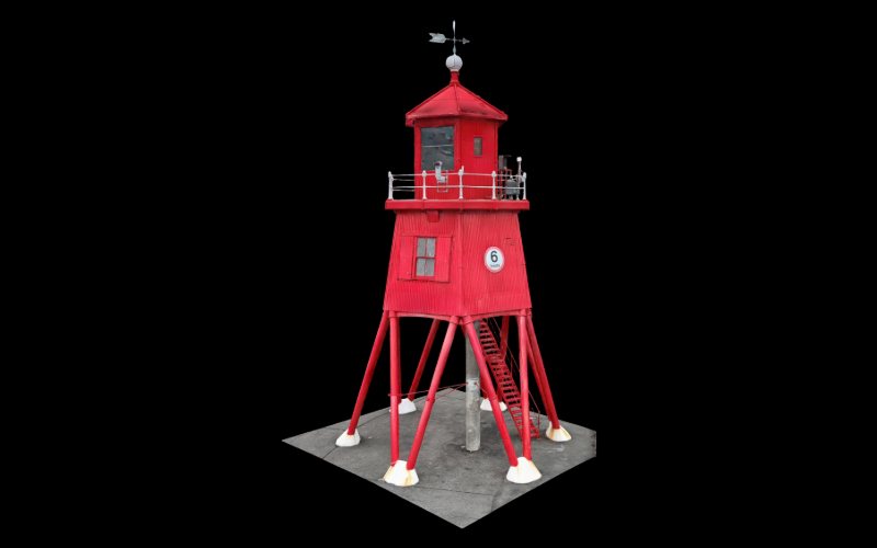
Open the full model to orbit, zoom and inspect it in your browser. It opens in a new tab.

What you receive
- Textured 3D modelsOBJ, FBXRealistic models of the building, structure or site
- Point cloudsLAS, LAZDense 3D data for CAD and modelling
- MeasurementsPDFSelected distances and areas, reported
- High-resolution imageryJPEGThe photographs used to build the model
- Interactive online modelBrowser linkA link to explore the model in a web browser and share it with your team
- CAD and 3D exportsAgreed per projectFormats to suit your software
Who uses it, and the decisions it supports
- Contractors and project managers
- Understand a site or structure when planning access, logistics and sequencing.
- Architects and engineers
- Context models and point clouds for design and assessment.
- Building owners and estates
- A detailed record of an asset's condition on a known date.
- Heritage and conservation teams
- Inspect high-level features before access is arranged.
How the work is done
- ScopeWhat the model is for, the level of detail needed and whether it must be measured.
- PlanOrbits, facade passes and roof passes planned around the subject, with airspace checks and RAMS.
- CaptureOverlapping photographs from many angles, with ground control where measurements matter.
- ProcessThe model and point cloud are built from the photographs and checked.
- DeliverA browser link and files in the agreed formats.
Completeness and measurement
A model can only show what the camera saw. Areas hidden by trees, neighbouring buildings or deep recesses may be incomplete or less detailed, and fine features such as cables or railings may not model cleanly.
Measurements from a model are reliable when the capture is controlled and checked. Where measurements will be relied on, ground control and checkpoints are used and the results reported. Otherwise, model measurements should be treated as preliminary.
What affects the result
- Camera coverage of every face of the subject
- Distance from the subject and image overlap
- Glass, water and shiny surfaces
- Ground control and checkpoints, for measured work
Indicative price
This is an introductory starting price for a straightforward project, not a fixed price for every site. Your quotation depends on the size and complexity of the site, travel, access, processing, ground control, reporting and the deliverables you need. VAT is additional.
Related projects


Frequently asked questions
Can I measure objects in the model?
Yes. Distances, heights and areas can be taken from the model, and some online viewers include measuring tools. For measurements that will be relied on, the capture is controlled with ground control and checkpoints, and the results are reported.
Can the model be viewed in a web browser?
Yes. Detailed models can be hosted on an online viewer and shared with a link, so your team can orbit and inspect the model without installing software. Who can open it depends on the sharing settings agreed for the project.
Can you model roofs and inaccessible areas?
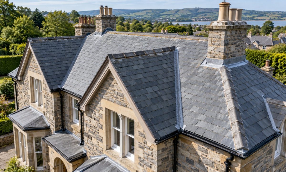
Yes. Roofs, towers, chimneys and high-level details are captured from the air, which is often the only practical way to see them closely without access equipment.
Roof and building inspectionsCan the model be used by architects or engineers?
Yes. Point clouds and models can be exported for CAD, BIM and modelling software. Whether the data suits design work depends on the control used and the accuracy needed, which we agree at the start.
How much does a drone 3D model cost?
General 3D photogrammetry models start from £650 + VAT. Your quotation depends on the size and complexity of the site, travel, access, processing, ground control, reporting and the deliverables you need.
Related services
All services