Drone Roof & Building Inspections
Inspect difficult-to-access areas without immediately committing to scaffolding or elevated access equipment.
Droneacres provides detailed aerial imagery of roofs, façades, chimneys and other building features, helping property professionals identify visible areas of concern and plan further investigation or maintenance.
Prefer to talk it through? Call 07970 393381.

Look before you scaffold
Scaffolding and access equipment are expensive to put up just to find out what is wrong. A drone inspection captures detailed images of the roof and upper elevations first, so you can see what needs attention, plan the work and decide what access is really needed.
Zoom cameras capture close detail from a safe distance, such as slipped slates, cracked flashings and blocked gutters. Images are organised by elevation and marked up where something needs attention.
Typical applications
- Roof condition documentation
- Chimney and high-level structure photography
- Gutter and drainage condition, where visible
- Façade documentation
- Storm damage photography
- Pre- and post-works comparisons
- Access planning
- Construction and maintenance records
What the images show
Inspection images are organised by elevation, with close-ups of anything that needs a closer look.

What you receive
- High-resolution photographsJPEGOverview images of every roof slope and elevation
- Close-up inspection imagesJPEGZoom images of details that need a closer look
- Annotated visual recordsPDFAreas of concern marked and located
- Building overview imagesJPEGContext images of the whole building
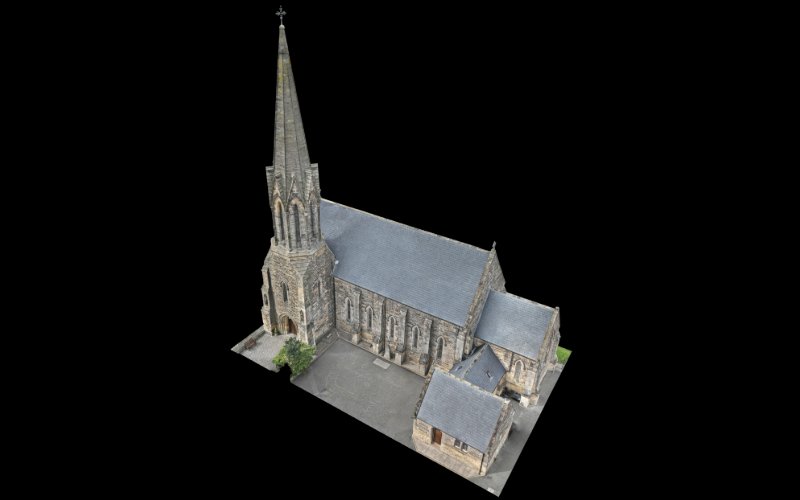
- Optional 3D modelsBrowser link, OBJA measurable model of the building
- Before-and-after recordsPDFImages repeated after repairs or works
What it gives you
Plan the right access
See what is needed before booking scaffolding or a cherry picker.
Better-informed quotes
Contractors can price work from clear, close images.
A dated record
Images show the condition of the building on the day.
How the work is done
- BriefThe building, what you need to see and any known problems.
- PlanAirspace checks, permissions, a risk assessment and RAMS, and a safe take-off point.
- CaptureOverview and close-up passes around the roof and elevations.
- ReviewImages are reviewed, organised and marked up.
- DeliverImages and an annotated record, with a 3D model if required.
What a drone inspection can and cannot show
A drone inspection records what is visible from outside. It cannot see inside the roof space, beneath coverings or behind gutters and flashings, and it cannot test materials or fixings by hand.
Not every defect will be visible, and some issues need a hands-on inspection to confirm. The images help your surveyor or contractor decide where closer investigation is needed and what access to plan.
What affects the result
- Light and shadow on each roof slope
- Moss, debris and standing water
- Trees and buildings close to the roof
- Wind on the day

Frequently asked questions
Can roof defects be identified without scaffolding?
Many visible defects can, such as slipped or missing slates and tiles, damaged ridges, flashings and lead work, and blocked gutters. Some issues are not visible from outside or need hands-on checks, so the images show where closer inspection is worthwhile.
How close can the drone get to a building?
Close enough for detailed images, while keeping a safe distance from the building, people and property. Zoom cameras capture fine detail from further away, so the aircraft rarely needs to be very close.
Can you inspect chimneys and gutters?
Yes. Chimney stacks, pots, flaunching, pointing and lead work are photographed from each side, and gutters are recorded where they can be seen from above.
Can the images help roofing contractors plan work?
Yes. Clear, located close-ups help contractors understand the job, price it accurately and plan the access and materials they need before arriving on site.
How quickly will I receive the images?
Inspection photographs can often be supplied the same day as the flight. Annotated records and optional 3D models take a little longer, and timescales are agreed for each project.
Related services
All services