Drone Mapping & High-Resolution Orthomosaics
Detailed aerial maps that allow you to see and measure your entire site.
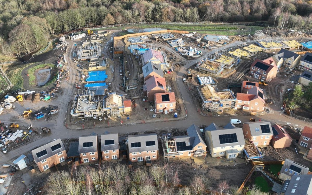
Droneacres produces high-resolution orthomosaics by processing overlapping drone photographs into a single georeferenced aerial map. These provide a detailed, measurable visual record of a construction site, development or area of land.
Indicative priceFrom £550 + VATWhat affects the price
Prefer to talk it through? Call 07970 393381.

An orthomosaic is not just an aerial photo
An ordinary aerial photograph has perspective: things nearer the camera look bigger, and scale changes across the image. An orthomosaic is built from hundreds or thousands of overlapping photographs and corrected so that scale is consistent across the whole map, like a plan.
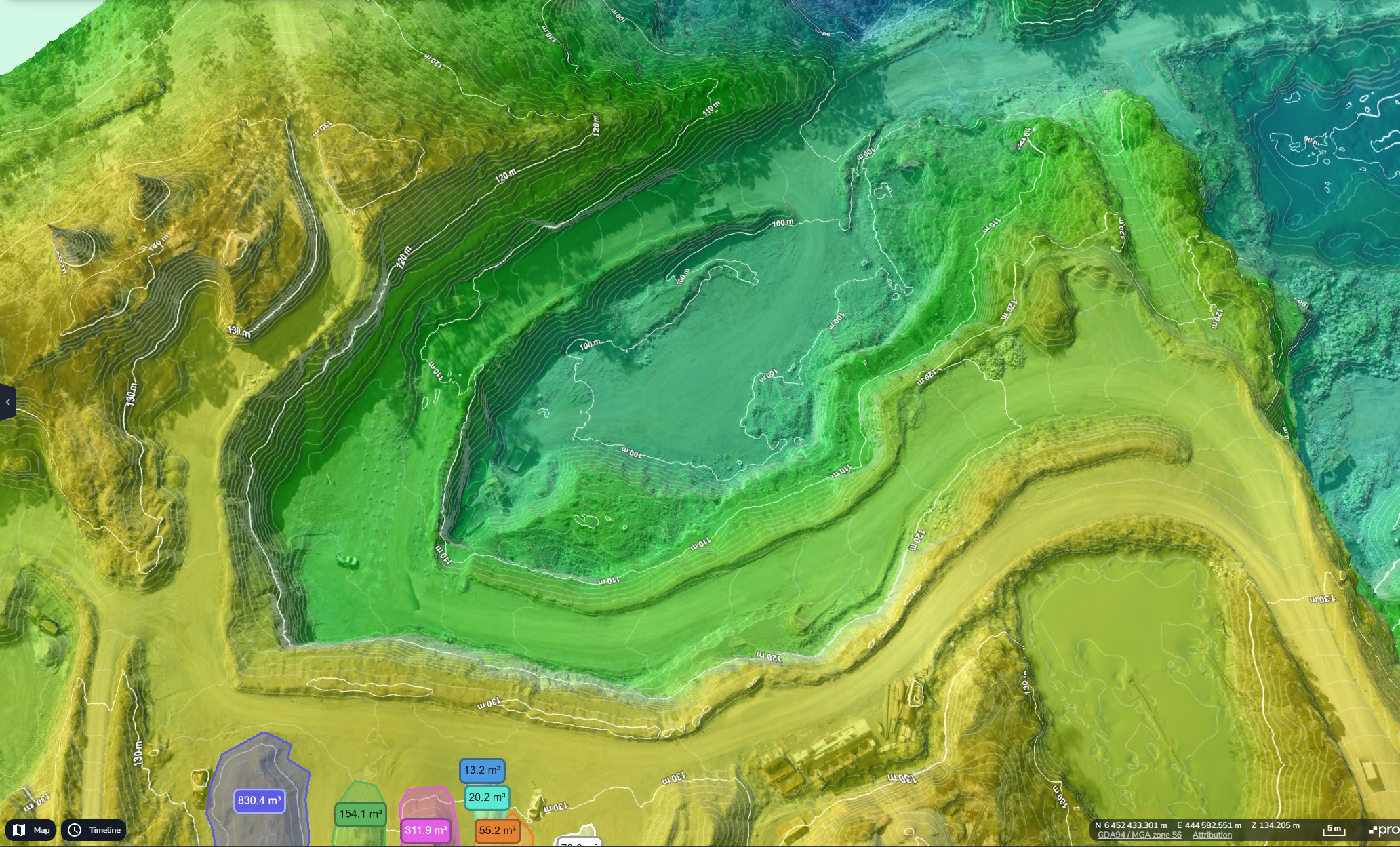
Because it is georeferenced, the map can be aligned with your drawings and with other surveys on the same coordinate system, and distances and areas can be measured directly from it. Image resolution is set by flight height, typically from 1 to 5 cm per pixel depending on the site and what the map is for.
Benefits
- Full-site visibility in a single image
- Site measurements and area calculations
- Planning and site coordination
- Documenting existing conditions
- Comparing different survey dates
- Sharing site information with contractors and consultants
Compare survey dates
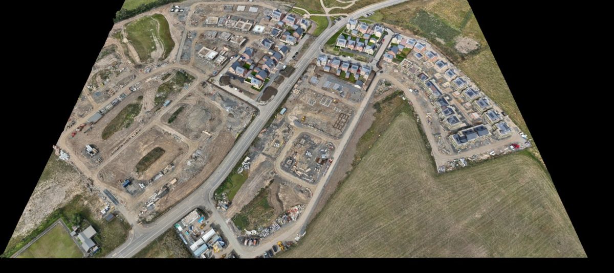
Two Droneacres orthomosaics of the same site, captured on the same flight plan and control, so change between dates is easy to see.

What you receive
- Georeferenced orthomosaicGeoTIFF, ECWThe full-resolution map on your coordinate system
- High-resolution image exportsJPEG, PDFImages for reports, presentations and planning documents
- Annotated site plansPDFThe map marked up with areas, labels or boundaries
- Area and distance measurementsPDF, CSVMeasured from the map and reported
- GIS-compatible rastersGeoTIFF, ECW, JPEG with world fileTiled or compressed rasters where requested
- Repeat-date comparisonsPDF, GeoTIFFThe same site mapped on later dates and compared
Who uses it, and the decisions it supports
- Site managers and engineers
- Plan compounds, logistics and haul routes from an up-to-date map.
- Designers and consultants
- A georeferenced base map for drawings and GIS.
- Project teams and clients
- One up-to-date, shareable view of the whole site.
- Landowners and developers
- A record of existing conditions before work starts.
How the work is done
- ScopeThe area to map, the detail needed, the coordinate system and file formats.
- PlanAirspace checks, a risk assessment and RAMS, with flight height set for the resolution.
- CaptureA grid flown with high overlap, with ground control where positional accuracy matters.
- ProcessThe photographs are processed into a single corrected map and checked.
- DeliverMap files in your formats, ready to view and measure in your own CAD or GIS software.
Resolution, accuracy and limitations
Resolution is how much ground each pixel covers. Positional accuracy is how closely features on the map match their true position, which comes from RTK positioning, ground control and checkpoints. Where accuracy matters, checkpoint results are reported with the map.
An orthomosaic shows what the camera could see on the day. Tall buildings and trees can lean or blur at their edges, and anything under tree cover or roofs is hidden.
What affects the result
- Flight height, which sets the resolution
- Ground control and checkpoints
- Tall structures and trees
- Light, shadow and weather on the day
Indicative price
This is an introductory starting price for a straightforward project, not a fixed price for every site. Your quotation depends on the size and complexity of the site, travel, access, processing, ground control, reporting and the deliverables you need. VAT is additional.
Regular surveys at agreed intervals or project milestones are priced at a preferential rate per visit, because planning and set-up are shared and the same capture and control methods are used each time.

Frequently asked questions
What is an orthomosaic?
A single aerial map stitched from many overlapping drone photographs and corrected so that scale is consistent across the image. Unlike a normal aerial photograph, it can be measured like a plan.
Can measurements be taken from the map?
Yes. Distances, areas and positions can be measured directly in CAD or GIS software. For measurements that matter, the map is controlled with ground control and checkpoints.
How detailed is the imagery?
Detail is set by flight height and the camera, and is typically between 1 and 5 cm per pixel depending on the site. Detailed construction sites are usually flown at the finer end, while larger areas that only need an overview can be mapped more coarsely.
Can maps be updated regularly?
Yes. The same area can be mapped weekly, monthly or at milestones, using the same flight plan and control so each map can be compared with earlier ones.
Construction progress monitoringHow quickly will I receive the map?
Delivery times depend on the site, the survey requirements and the outputs you need. Inspection imagery can often be supplied the same day, and maps and 3D models can often be prepared within about two working days. More complex mapping and surveying deliverables may take around three working days or longer. Timescales are agreed for each project.
How much does drone orthomosaic mapping cost?
Orthomosaic mapping of a straightforward site starts from £550 + VAT. Your quotation depends on the size and complexity of the site, travel, access, processing, ground control, reporting and the deliverables you need. Regular surveys at agreed intervals or project milestones are priced at a preferential rate per visit, because planning and set-up are shared and the same capture and control methods are used each time.
Related services
All services