Drone Topographical Mapping & Terrain Models
Measured levels, contours and terrain models of your site.
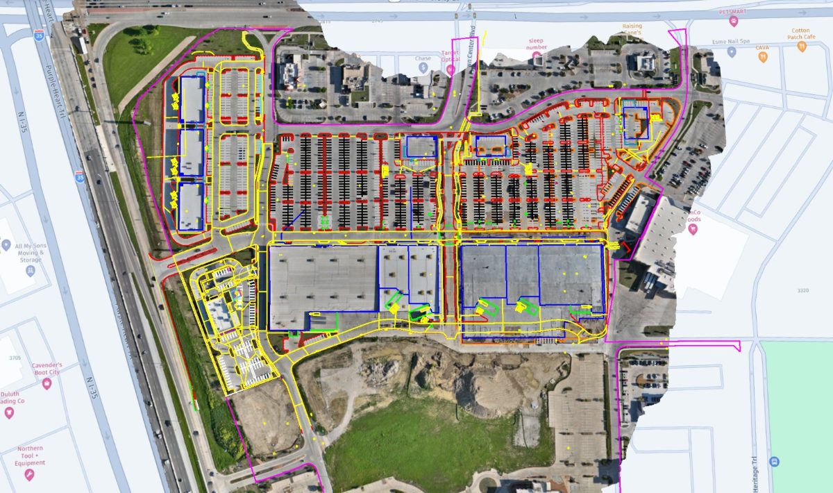
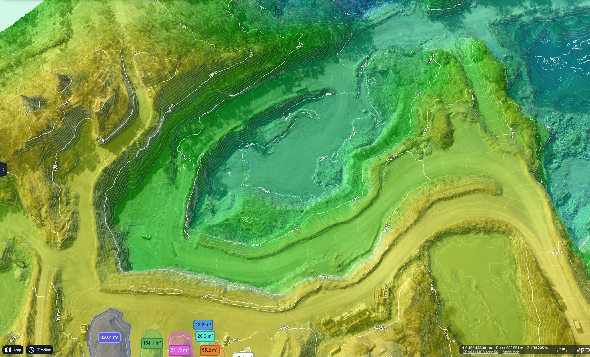
Droneacres turns overlapping drone photographs into georeferenced elevation models, contours, spot levels and point clouds that engineers and designers can use in CAD and GIS. One flight records the visible ground across the whole site, so levels, slopes and earthworks can be assessed from the office.
Indicative priceFrom £850 + VATWhat affects the price
Prefer to talk it through? Call 07970 393381.


The datasets, explained
Photogrammetry turns thousands of overlapping aerial photographs into measured 3D data. From that data we produce the layers below. Each one answers a different question about the site, so the right combination depends on what your engineers or designers need.
How the data helps
- Early-stage site planning and feasibility
- Earthworks assessment
- Surface level analysis
- Site visualisation for clients and planners
- Understanding slopes and how water is likely to run across the site
- Providing mapping data to engineers and designers
Surface and terrain terms
- Digital Surface Model (DSM)
- The height of everything the camera sees, including buildings, vehicles, trees and stockpiles.
- Digital Terrain Model (DTM)
- The ground surface, with buildings, vegetation and other objects removed as far as the data allows.
- Contours
- Lines joining points of equal height, at an interval chosen to suit the site.
- Spot heights
- Individual levels at specific points, such as corners, kerbs or ground features.
- Elevation profiles
- A cross-section showing how the ground rises and falls along a line.
- 3D point clouds
- The millions of measured points that make up the surface, for CAD and modelling software.
Compare surfaces between dates
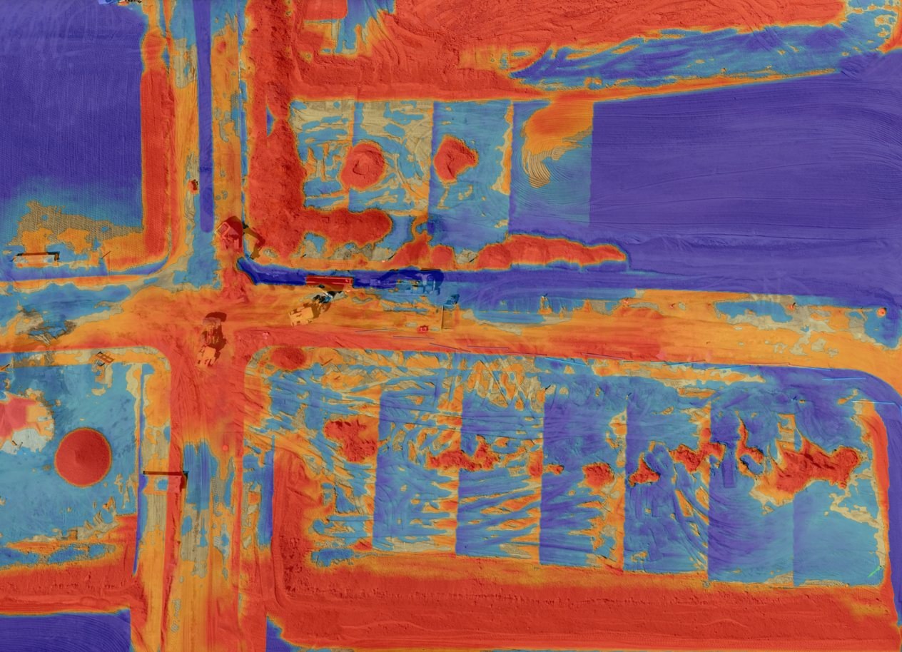
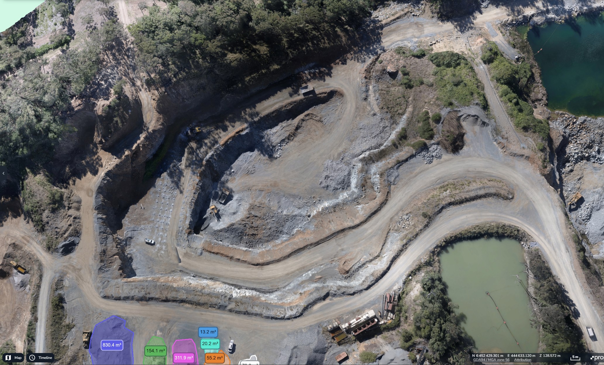
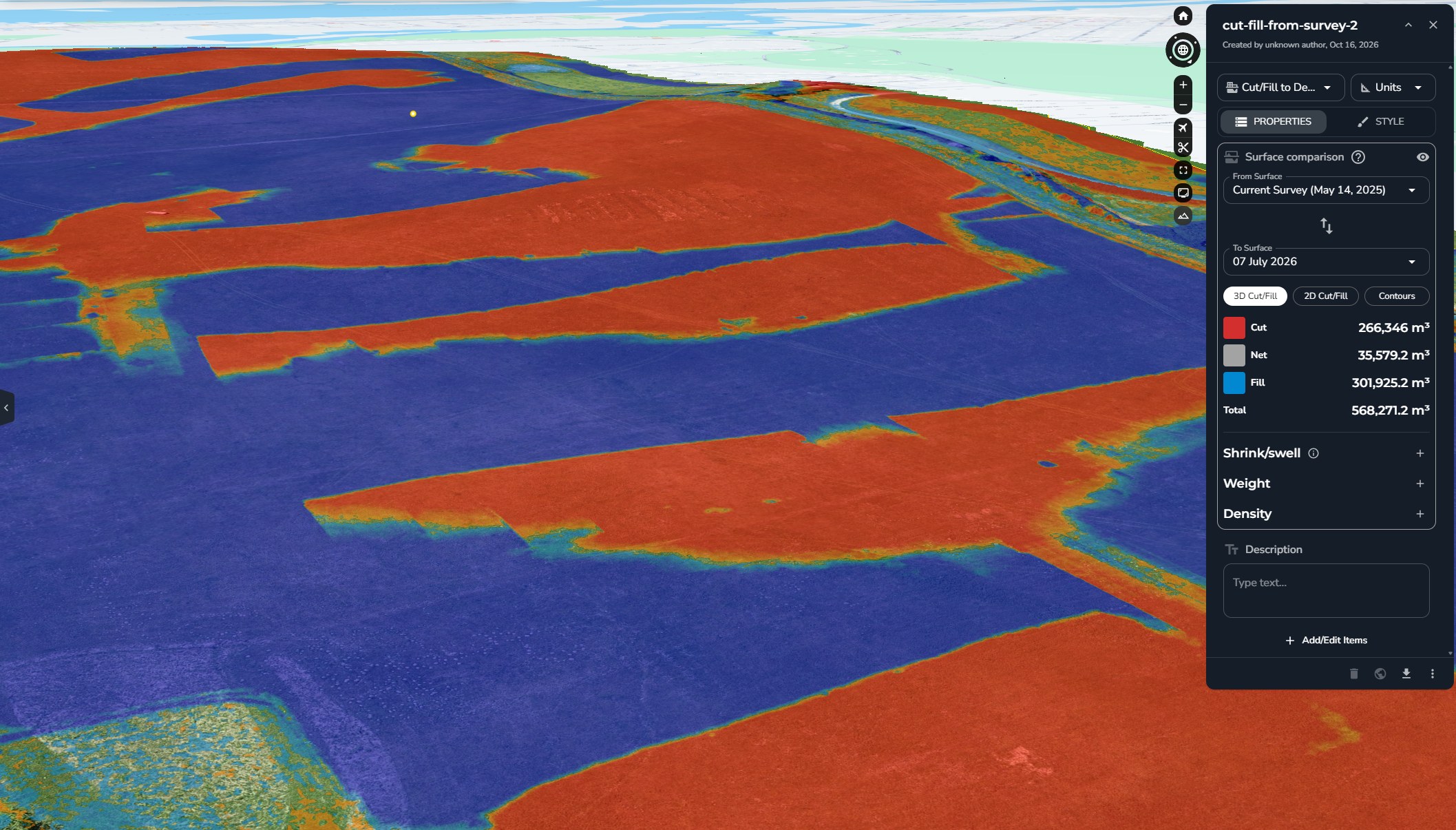
Once the ground has been measured, a later survey or a design surface can be compared with it. The colours show where the ground is higher or lower, and the difference is calculated as cut, fill and net volumes in cubic metres.

What you receive
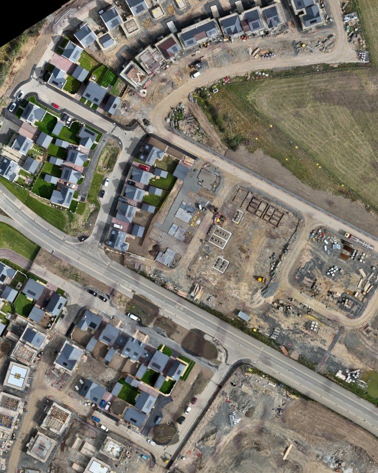
- Georeferenced orthomosaicsGeoTIFF, ECWA measurable aerial base map of the site
- Elevation modelsGeoTIFFSurface (DSM) and terrain (DTM) heights
- Contour datasetsDWG, DXFContours at your chosen interval
- Spot levelsDWG, DXF, CSVLevels at agreed points, where appropriate
- Point cloudsLAS, LAZThe dense 3D survey data
- Sections and terrain surfacesPDF, LandXMLCross-sections and surfaces for design software
- Drafted CAD drawingsDWG, DXFFully drawn topographical linework, available by arrangement
Who uses it, and the decisions it supports
- Housebuilders and developers
- Site appraisal, layout planning and early earthworks estimates.
- Civil engineers and designers
- Existing levels and surfaces for drainage, road and platform design.
- Architects and planning consultants
- Base mapping, levels and context for layouts and planning drawings.
- Contractors
- A pre-start record of the ground to compare against later surveys.
How the work is done
- RequirementsWhat the data is for, the tolerances needed, outputs, contour interval and coordinate system.
- PlanAirspace checks, a risk assessment, RAMS and a flight plan set for the detail required.
- ControlGround control points and independent checkpoints measured with GNSS on your coordinate system.
- Capture and processThe site is flown, the imagery is processed into the agreed outputs, and the results are checked against the checkpoints.
- DeliverData in the formats your team uses, with a short report on control and checkpoint results.
What photogrammetry can and cannot see
Photogrammetry measures the surfaces visible in the photographs. Where trees, dense vegetation, buildings or parked vehicles hide the ground, the level beneath cannot be measured from the air, and a terrain model in those areas is an estimate. Where practical, spot levels are taken on foot with our GNSS receiver to fill gaps.
Aerial photogrammetry does not provide an underground services survey or a legally verified boundary survey, and it does not automatically meet the specification of every topographical survey. Survey control, checkpoints, site conditions and your required tolerances decide whether the data suits a particular use, and we will tell you plainly if it does not.
What affects the result
- Ground control and independent checkpoints
- Flight height and image overlap
- Vegetation, long grass and tree cover
- Water, glass and other reflective surfaces
- Shadows, steep faces and overhangs
Indicative price
This is an introductory starting price for a straightforward project, not a fixed price for every site. Your quotation depends on the size and complexity of the site, travel, access, processing, ground control, reporting and the deliverables you need. VAT is additional.
Frequently asked questions
Can drone mapping replace a traditional topographical survey?
Sometimes, but not always. For open and developed sites it can provide ground models, contours and spot levels efficiently. It does not cover underground services or legal boundaries, and it cannot measure ground hidden under dense vegetation or buildings. Whether it can replace a particular survey depends on the tolerances and specification required.
What accuracy can be achieved?
That depends on ground control, checkpoints, flight parameters and site conditions, so we do not quote a single figure. Each survey is checked against independent checkpoints and the results are reported, so you can see whether the data meets your tolerance.
Can you produce contours?
Yes, at an interval that suits the site and the accuracy achieved, for example 0.25 m, 0.5 m or 1 m. Contours are generated from the terrain model and supplied as CAD linework.
Can I import the data into CAD?
Yes. Contours and spot levels are supplied as DWG or DXF, surfaces as LandXML and point clouds as LAS or LAZ, on the coordinate system your project uses. Fully drafted topographical drawings, with site features drawn up as CAD linework, are available by arrangement through a specialist surveying contact.
What happens where vegetation obscures the ground?
Photogrammetry cannot see through dense vegetation, so the ground beneath it cannot be measured from the air. These areas are identified in the deliverables, and where practical, spot levels are taken on foot with GNSS.
How quickly will I receive the data?
Delivery times depend on the site, the survey requirements and the outputs you need. Inspection imagery can often be supplied the same day, and maps and 3D models can often be prepared within about two working days. More complex mapping and surveying deliverables may take around three working days or longer. Timescales are agreed for each project.
How much does drone topographical mapping cost?
Topographical surface mapping of a straightforward, open site starts from £850 + VAT. Your quotation depends on the size and complexity of the site, travel, access, processing, ground control, reporting and the deliverables you need.
Related services
All services